








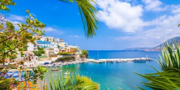


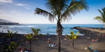



A few years ago, I was sipping wine at a restaurant in Rethymno, a historic coastal city in northern Crete.
The atmosphere was relaxed, the weather was great, and the people were friendly. Looking back, it’s hard to picture this Greek island looking any different than it did that day.
However, a leading Greek seismologist has just warned residents and tourists that Rethymno should brace itself for a possible tsunami. And, that it would be wise to put serious evacuation plans into place.
Efthymios Lekkas, a professor of dynamic tectonics, applied geology and natural disaster management, raised concerns at a recent conference in the city.
Lekkas, who works at the National and Kapodistrian University of Athens and is president of Greece’s Earthquake Planning and Protection Organisation (OASP), stated that ‘Rethymno must be prepared for a tsunami.’

The professor backed up the claim with findings from an updated seismic risk assessment conducted by his research team, which stated that the threat has been ‘scientifically calculated.’
During the conference, Lekkas noted that, should a tsunami hit, two areas of the city would face significant evacuation difficulties.
The first is the eastern part of the city, where a combination of densely built hotels, low-lying terrain, and the local road network could obstruct people getting to safety.
The other is the Old Town, due to its labyrinth of old narrow streets.
However, Lekkas stressed that seismic activity in Rethymno would not be comparable to more serious events in Japan, Indonesia and Chile.
He was specifically referring to the 2004 Indian Ocean disaster and the tragic tsunami that struck Japan in 2011.

Lekkas’s research is a collaboration between the Municipality of Rethymno and the university, which aims to reduce tsunami risk and improve the city’s emergency earthquake response.
What do the seismologists say?
Dr. Margarita Segou, an earthquake seismologist at the British Geological Survey, says tsunami hazard assessment has advanced significantly in recent years, driven by improved computational capabilities and scientific progress.
‘For the Mediterranean coastline, the most credible data currently comes from the 2018 Tsunami Hazard Model,’ she tells Metro.
This is a scientific computer map and calculator that estimates the likelihood and size of tsunamis caused by earthquakes across the North-East Atlantic, the Mediterranean Sea, and the Black Sea (known as the NEAM region).
To put this hazard into a broader regional perspective, she says Rethymno’s estimates are comparable to those for Catania in Sicily.
However, Segou adds that it’s also crucial to understand that coastal cities along the active Hellenic Trench (a sweeping arc of underwater canyons, troughs, and steep slopes in the eastern Mediterranean Sea) generally face a two- to three-fold higher probability for similar tsunamis.

She says this ‘marks a zone from western Peloponnese to south Crete that bears the highest tsunami hazard in the region.’
Globally, Segou notes that ‘coastal cities in earthquake-prone regions should prepare for these hazards and associated risks,’ and Rethymno is no exception.
When relaying scientific results to local communities, she says ‘we should always rely on the best available science and exercise caution to ensure findings are interpreted accurately and responsibly.’
Still, on the somewhat bright side, Lekkas’s research concluded that, while Rethymno does have a very real tsunami risk, the city is better equipped to deal with natural disasters compared to other Greek regions.
‘The Municipality of Rethymno has a significant advantage over other municipalities in the country: It has extensive experience in scientific planning for natural hazards,’ he said.